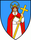
Map - Kastav

Kastav
Kastav (Italian: Castua) is a town in Primorje-Gorski Kotar County, Croatia, built on a 365 m high hill overlooking the Kvarner Gulf in the northern part of the Adriatic coast. It is in close vicinity of Rijeka, the largest port in Croatia, and the Opatija Riviera, one of the popular tourist destinations in Croatia.

The total population of Kastav is 10,265 (census 2021).

The census of 2001 had recorded the following settlements:

* Brnčići, population 677

* Ćikovići, population 3,089

* Kastav, population 2,037

* Rubeši, population 1,722

* Spinčići, population 876

* Trinajstići, population 490

In the 2011 census, all of the settlements were merged into a single settlement; Kastav. 
Map - Kastav
Map
Google - Map - Kastav
Google
Google Earth - Map - Kastav
Google Earth
Nokia - Map - Kastav
Nokia
Openstreetmap - Map - Kastav
Openstreetmap
Map - Kastav - Esri.WorldImagery
Esri.WorldImagery
Map - Kastav - Esri.WorldStreetMap
Esri.WorldStreetMap
Map - Kastav - OpenStreetMap.Mapnik
OpenStreetMap.Mapnik
Map - Kastav - OpenStreetMap.HOT
OpenStreetMap.HOT
Map - Kastav - OpenTopoMap
OpenTopoMap
Map - Kastav - CartoDB.Positron
CartoDB.Positron
Map - Kastav - CartoDB.Voyager
CartoDB.Voyager
Map - Kastav - OpenMapSurfer.Roads
OpenMapSurfer.Roads
Map - Kastav - Esri.WorldTopoMap
Esri.WorldTopoMap
Map - Kastav - Stamen.TonerLite
Stamen.TonerLite
Country - Croatia
Currency / Language  
ISO Currency Symbol Significant figures
HRK Croatian kuna kn 2
Neighbourhood - Country  
  •  Bosnia and Herzegovina 
  •  Hungary 
  •  Montenegro 
  •  Serbia 
  •  Slovenia